
INDIAN ARMED FORCES CHIEFS ON
OUR RELENTLESS AND FOCUSED PUBLISHING EFFORTS
SP Guide Publications puts forth a well compiled articulation of issues, pursuits and accomplishments of the Indian Army, over the years

I am confident that SP Guide Publications would continue to inform, inspire and influence.
My compliments to SP Guide Publications for informative and credible reportage on contemporary aerospace issues over the past six decades.
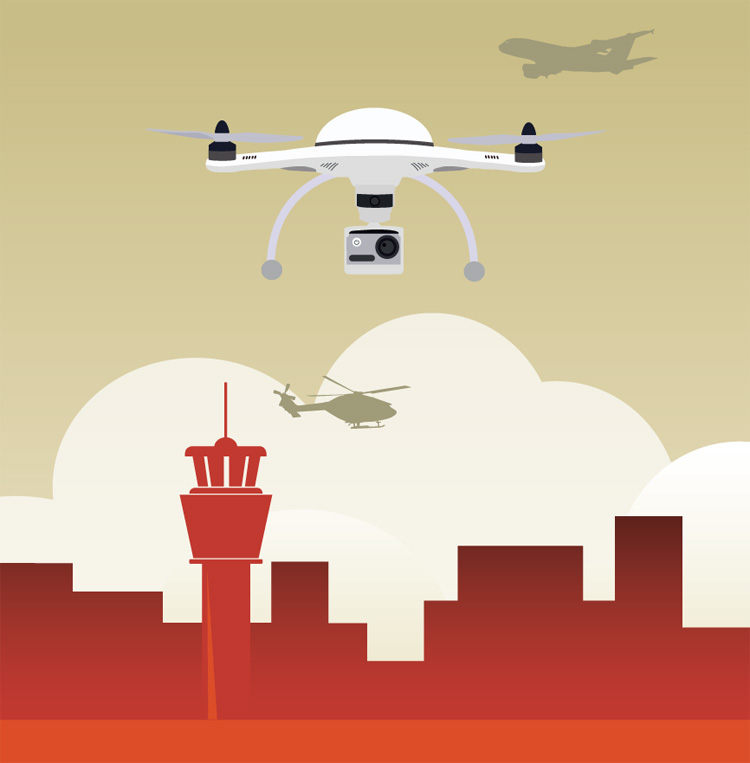
Potential of UAVs in Civil Aviation
Initially inducted exclusively for military use, the potential of UAVs are now being exploited in the domain of civil aviation as well
Unmanned Aerial Vehicles (UAV) being extremely versatile flying machines, have recently elicited keen interest from different stakeholders. On the one hand, while UAVs that are low-cost and versatile platforms offering a variety of aerial applications, on the other its inconspicuousness can easily be exploited by unscrupulous elements and prove to be serious threat to the society. Hence, there is a need to not only develop applications for the UAV, but credible safeguards against its malicious use as well.
A UAV is a machine that is flown by a pilot who is located on ground. Since no human is on board, it reduces the size of this flying machine, enables higher payloads to be carried, dispenses with the need for long airstrips and minimises the need for trained manpower.
UAVs are of multiple types. The inventory of available UAVs ranges from small hand-launched machines to large, long endurance machines that require a runway for operations. UAVs can carry multiple payloads such as cameras of all types, ion-based/sensitive sensors, radio relay equipment, pylons for delivery of lights stores etc. The range of applications of UAVs depends on the sensor/pod mounts and the imagination of the user. Initially inducted exclusively for military use, the potential of UAVs are now being exploited in the domain of civil aviation as well. Some of the roles of the UAVs in civil aviation are enumerated in the succeeding paragraphs.
AERIAL PHOTOGRAPHY AND SURVEILLANCE
Aerial photography is the most popular use of the UAV. One can mount calibrated infrared, ultraviolet, thermal or normal visible light spectrum cameras. The better the resolution of the camera, the clearer will be the image even on magnification. Such cameras will enable the device to fly higher and thus acquire a broader swath of the surface area under scan. This will reduce the cost of acquisition of photographs of large tracts of land and also eliminate multiple missions. In the event infrared cameras are used, dependence on expensive satellite imagery for crop yield estimation can be mitigated. A satellite usually has a fixed window of timeline to overfly a given area. However, as a UAV can be flown at will, it bestows considerable flexibility to the user. UAVs can be employed to quickly estimate crop damage due to natural disasters and design schemes to compensate affected farmers to prevent penury caused suicides.
Survey of India has already switched over from manual methods of survey to use of UAVs mounted with calibrated cameras. All that is required now is to update existing maps for reduced crop/forest cover, advancing civilisation and change of course of rivers. A picture of the desired area taken from a UAV duly scaled, is used to update the old map. The UAV is the fastest way of getting topographical data of new areas.
Recently film makers too have taken to using camera mounted UAVs as the platform that provides a vertical or a slant visage of the subject being filmed. This brings a totally new experience to the viewer. It has introduced an element of thrill in movies that are shot near steep fort walls. UAV-based filming eliminates the risk of crew and equipment falling over walls, thus, reducing the cost of photography and the associated insurance premiums.
In disaster management, UAVs can be effective in restoring communication, assessing damage in the affected areas and flying in small succor and emergency supplies
UAVs can also be deployed to photograph areas along alignments where a new road or rail track is to be built. This data can be used by the concerned agencies to evaluate economic feasibility and work out costs. Contractors can prepare technical and financial bids based on the UAV imagery.
The vertical takeoff and landing capability of small UAVs enable them to be deployed in open shaft mines. The miners use explosives to loosen the earth to look for the desired minerals. This is where these versatile UAVs come in. The UAV can be flown to locate the best spot where the explosive needs to be planted to loosen the maximum earth. The UAV should then be used to see the best way to move in cranes and dumpers to extract the minerals after the blast. This will save time, money and also minimise the risk to human lives, thus increasing profitability of mining operations.
Contractors can use UAVs to acquire images of areas where they wish to start construction projects. This will enable them to estimate costs pragmatically and schedule their work to prevent cost and time overruns by keeping check on progress. Contractors can check with UAVs as to whether their onsite staff is working or not. The UAVs with suitable cameras can also check for onsite pilferages, other loss generating actions and safeguarding of assets by day and night surveillance of the areas of interest. It will be an excellent idea to carry out surveillance using UAVs over gated communities where security is paramount.
CARGO DELIVERY
Delivery of small size cargo including time-sensitive emergency medical supplies between hospitals such as implants or organs, can be done using UAVs. The UAV can fly along the shortest route to reduce delivery time, eliminate delays due to road congestion and accidents.
RADIO LINK
Radio shadow areas between transmitting stations can be covered by deploying UAVs having radio rebroadcast equipment. This will be particularly effective over wilderness, remote areas where either a plane has crashed or where a disaster has struck. The range of existing transmitters too can be enhanced by temporarily deploying such equipment mounted on a UAV.
DISASTER MANAGEMENT
When disaster strikes, usually all means of access, sustenance and recovery are devastated. It is a known fact that the maximum lives can be saved in the initial hours after a disaster. This is where UAVs can be really effective in restoring communication, assessing damage by sending photographs of the affected areas and flying in small succor and emergency supplies apart from establishing temporary links with the struggling areas as disaster relief forces rush in.
HARBOUR MANAGEMENT
Harbor management is a tricky aspect. This is so because unlike an Air Traffic Control tower that only has to keep alert and monitor aircraft flying in and out of the designated funnel so created, a harbour has boats and ships coming in at all times and from all directions. As a result, it is quite common to learn that small boats and trawlers keep colliding with each other. This problem can be mitigated to quite an extent if the Captain of the Port or the Harbour Master is provided with live feed obtained from the loitering UAVs both at day and at night. This will be very useful in foggy conditions if thermal cameras are mounted on UAVs. It will prevent loss of assets, lives and blockage of the limited harbour channels by preventing accidents.
REGULATORY ISSUES
A UAV can also be exploited by unscrupulous elements to cause damage to the society. Hence, there is a need to regulate the acquisition and usage of UAVs through a regulatory framework without crippling this asset.The policy framework can be the same as for private jets promulgated by Directorate General of Civil Aviation (DGCA) for the metro cities, sensitive installations and vulnerable areas such as airports, etc. For Tier-II and -III cities, rules need to be framed based on the damage potential an unscrupulous elent can command with a UAV. The nodal agency for this will be DGCA in consultation with the Indian Air Force base in the area. Where no air base exists, the nearest base of the Indian Army would have to be involved. For hinterland areas in the, the police would have to be involved.
A ceiling height should also be laid down, above which the UAVs should not be allowed to fly to avoid conflict with civil air traffic. This can be achieved by installing mechanical governors on the UAV flying consoles. The embedded programmes on board the UAVs that connect the operational command with the mechanical propellers too can be written is such a way that height restrictions can be imposed as default restrictions. Where the threat to commercial aircraft does not exist, such restrictions can be waived or specific permission be taken from the DGCA.
Air safety can also be ensured by the DGCA certifying the maximum all up weight and pylon configuration for each category of UAV that is acquired in India. Accordingly, vulnerable loads can be specifically defined to minimide accident-related collateral damage.
Air Traffic Management can be ensured by assigning specific flight paths between popular destinations and UAV density at any given time by the regional DGCA or the Airport Authority of India office. Evolution of flying protocols and promulgations will be done by involving all stakeholders. The public too be encouraged to report near-miss and hazardous operations by UAVs to enhance public safety. Any carelessness or violation of the laid down norms should be dealt with severely.
Each UAV acquired or built in India, should have a unique etched number, duly registered and traceable to its owner. The flyers entitled to handle the UAV should have formal training and each flight plan should be recorded online with the DGCA for forensic accountability. The UAV is an agile piece of airborne equipment, but its low-cost and easy availability should be monitored to prevent misuse.
SP's Aviation - Current Issue